
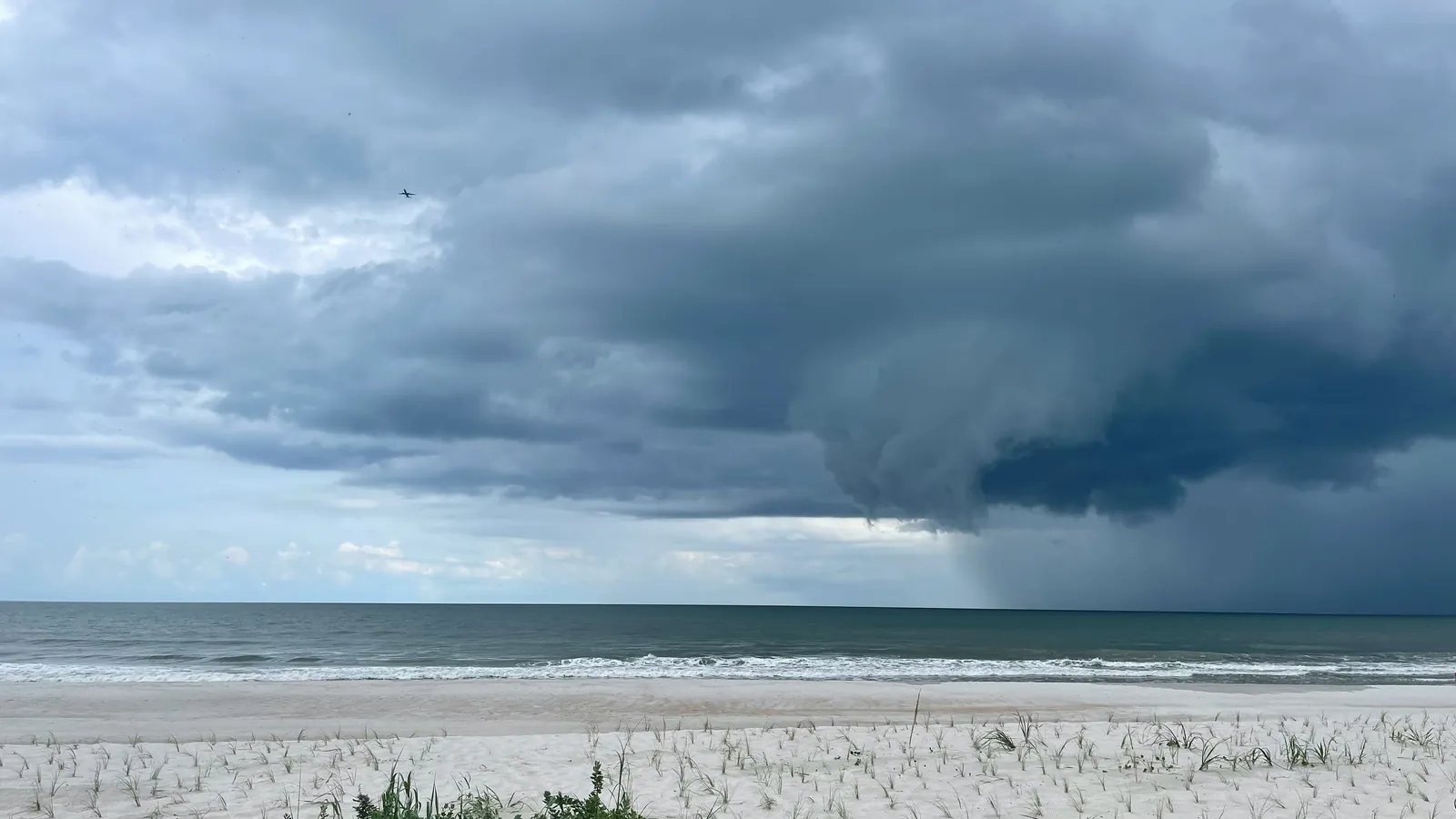
Squalls and lightning offshore: spotting, timing, and handling them
A squall is a sharp, short rise in wind, usually with rain and a wind shift, and lightning is the hazard that comes with it. Both are the result of a convective cloud. A forecast that looks benign at your current location can still give you a difficult time in open water.
This page covers how to read a squall coming, when convection is most likely to fire, what a forecast can and cannot show you about it, and how to handle the wind and the lightning when they arrive. None of it replaces a watchful eye and monitoring the radar.
You plan for them, then you watch for them.
Squalls and lightning both come from convective clouds, the tall, building cumulus that rise when the air is unstable and something lifts it. That shared origin is the key. A forecast can tell you the atmosphere is primed for convection along part of your route and part of the day, so it can rate the risk as elevated hours ahead.
What no forecast can do is point at the one cell that will pass over the boat or name the minute that it will hit. The cells are small, and they form, move, and die on a scale finer than any model resolves. So you do two things. You plan for the risk with the forecast, reefing the sails and timing your passage around the worst of it, and then you watch for the actual cell with your eyes and your radar.
Six things to know about squalls and lightning.
Learn to recognize these and a building cloud stops being a surprise and becomes a problem you already foresaw.
- What a squall is: A gust front rolling off a convective cloud. The wind rises fast and shifts, the rain usually comes with it, and the wind often drops sharply and then veers as the front passes. It is brief and hard, not a steady blow.
- Spotting them: Radar is your primary live tool. A squall paints as a bright return with a hard leading edge, and you can watch it move across successive sweeps. The sky backs it up: tall cumulus, a dark flat base, an odd calm just before it hits.
- Lightning and its reach: Strikes can reach well ahead of and behind the visible cell, so the rain is not the only danger zone. At sea your mast is the highest point for miles. Judge distance of the lightning by counting the seconds from the flash to when you hear the thunder.
- Timing: Convection builds with daytime heating over land and in the afternoon, fires along fronts and convergence lines at any hour, and can build at night over warm water like the Gulf Stream or the tropics.
- Handling the squall: Reef early while it is still easy. Bear away to ease your sheet and make sure you secure the deck. Expect the wind to shift as the front passes and steer through it. Then ride it out in a controlled fashion.
- Lightning aboard: Stay low and inside if you can, keep off the rigging and large metal objects, and unplug or isolate electronics. Bonding wires can carry a strike to ground, but they cannot promise protection. You reduce the risk, but you cannot eliminate it.
Radar shows the squall live on the chartplotter.
At sea, the single most useful tool for seeing a squall is your radar. A marine radar displays rain, so a squall or a convective cell shows up as a bright return with a hard leading edge. Unlike a forecast that does not have the spatial resolution to tell you exactly where the cell will be, the squall appears live on the chartplotter at its actual range and bearing.
Watch it over successive sweeps and you can see it move. That tells you whether the cell will cross your track or pass clear, and the range rings and the heading line let you judge how long until it reaches you. You can steer for the gaps the same way you would navigate around other ships. At night, when you lose the visual cues from the clouds entirely, radar plus any lightning you can see becomes your early warning system.
Radar is complementary to looking out the helm window, and does not replace it. Read its limits too. Small or weak showers can be faint, and heavy rain close in can shadow a second cell sitting behind it.
A risk you can plan around, not a cell you can pinpoint.
A model can see when the atmosphere is primed for convection. It reads the instability, the moisture that feeds a rising cloud, and the trigger that would set it off, and where both line up it can flag a stretch of your route as a place convection is likely. That risk can be rated hours ahead, which is enough to shape your plan. You can shorten sail before you reach it, time your departure to miss the worst of the heating, or route to keep clear of a known convergence line.
What the model cannot do is place the individual cell or name the exact minute it strikes. Squalls form and move on a fine scale, and two boats a few miles apart can have completely different afternoons. So read an elevated squall or lightning risk for what it is, a span in which you should be ready.
The ingredients that flag high squall and lightning risk.
A forecast predicts the elements that form the cells. These are the textbook ones, named in plain language, so you know what a model is assessing when it rates the risk as elevated.
High squall risk
A squall needs several things to come together. The air has to be unstable, with warm, moist air below colder air aloft, so the air wants to rise. There has to be enough moisture to feed a cloud. Something has to lift the air to set it off, a front, a convergence or sea-breeze line, or daytime heating. The cap of warmer air aloft that can suppress storms has to be weak. And wind shear, the wind changing speed or direction with height, organizes scattered cells into stronger, longer-lived squall lines. A falling barometer or an approaching front is the key flag that these are lining up.
High lightning risk
Lightning needs the convection to be deep and vigorous, a tall cloud with strong updrafts and a cold mid-level layer holding ice and supercooled water. The charge separates where ice crystals, graupel, and supercooled droplets collide in that mixed-phase zone, so lightning tracks closely with the tallest, most energetic storms and largely spares the shallow ones.
Every one of these ingredients is a meteorological variable that can be measured and analyzed, from the instability and the moisture in the air column to the strength of the cap, the wind shear, and the depth of the convection. That is what lets a model read them along a route and rate the risk, instead of leaving it to a glance at the sky.
From a quiet sky to defensive sailing.
A practical read on what each level of convective risk looks like on deck, and what it should change about how you sail.
| Risk level | What it looks like | What to do |
|---|---|---|
| ◆ Low squall risk, negligible to isolated lightning | Fair-weather cloud, a stable sky, nothing building. Clean radar. | Sail normally and keep a normal watch. Glance at the sky and the radar each watch change. |
| ▲ Moderate to high squall, scattered lightning | Cumulus building through the day, the odd dark base, cells showing on radar nearby. | Reef down ahead of time. Watch the sky and the radar closely and pick your gaps between cells. |
| ■ Severe squall, likely to severe lightning | Tall anvils, a hard squall line, frequent lightning, strong gust fronts. | Sail defensively. Reef ahead of time, stay low and inside in lightning, and avoid the area if you can. |
The levels are a guide. A moderate rating with one nasty cell on your track is worse than a high rating you sail clear of. The rating tells you how ready to be. Your eyes and your radar tell you what is actually coming.
Seeing where the convective danger concentrates.
WeatherWindow.AI computes per-hour Squall Risk and Lightning Risk as 0-100 tiered scores along your actual route. The Squall Risk factors in the instability, the moisture, whether something is there to lift the air, how weak the cap is, and the shear that organizes cells. The Lightning Risk reads the depth and vigor of the convection and the ice held aloft. A bad enough hour is what tips a leg from GO toward CAUTION or NO-GO in the overall call. You see where the convective danger concentrates before you leave and while underway, so the stretch where you reef early and watch the radar is flagged ahead of time rather than discovered at sea. You read the risk behind every hour, and you make the final decision.
Squall and lightning questions, answered.
Can a forecast predict squalls and lightning offshore?
Not the exact cell. A forecast reads the ingredients for convection, an unstable atmosphere and a trigger to set it off, so it can tell you the risk is elevated for a stretch of your route and a span of hours. It cannot place the individual squall or name the minute it hits. So treat an elevated squall or lightning risk as a timeframe to be ready, not a guarantee of where it strikes. You plan for them with the forecast, and you watch for them with your eyes and your radar.
How do I spot a squall coming?
Watch the sky and the radar. Tall cumulus that keep building, an anvil spreading off the top, a dark flat cloud base, or a line of cloud low on the horizon all say convection. On radar a squall shows up as a hard edge with a strong signal in the center. Closer in you may get a tell on deck, an odd calm or the wind veering and dropping just before the gust front arrives. At night you lose the visual cues from the clouds, so radar and any lightning you can see become your main warning.
What should I do when a squall hits?
Reef early, while it is still easy. The wind in a squall arrives fast and often shifts, so reef before the gusts arrive rather than after. Bear away to ease the load on the sails, ease your sheets, and get the deck and the crew secure with everyone clipped in. Expect the wind to veer or back as it hits and be ready to steer through the changes. The uptick in wind is usually short, often ten to forty minutes, so the goal is to ride it out in a controlled setting rather than to outrun it.
Is my boat safe from lightning at sea?
You can lower the risk, but you cannot remove it. At sea your mast is the high point for miles, which makes a sailboat an easy target. If a storm is on you, stay low and inside the cabin if you can, keep clear of the mast and large metal, and unplug or isolate electronics, including handhelds. A bonded rig can carry a strike to ground and may protect the hull, but no system promises that the crew or the electronics come through unharmed. The honest answer is that you can reduce the odds and the damage, you cannot eliminate them.
When are squalls most likely?
Whenever the air is unstable and something lifts it. Over and near land that often means the afternoon, after daytime heating has built the instability. Along fronts and convergence lines squalls can fire at any hour, because the front itself is the trigger. Offshore the pattern can flip, with convection building at night over warm water like the Gulf Stream or the tropics, where the sea stays warm after the air above cools. So know your waters, the season, and the synoptic setup, and watch hardest when the ingredients line up.
What is the difference between a squall and a thunderstorm?
A squall is the wind event, a sharp short rise in strong wind that usually brings rain and a wind shift. A thunderstorm is the convective cell that often carries that squall, and the cell is what adds thunder and lightning. So you can get a squall under heavy cloud with little or no lightning, and you can get a thunderstorm whose gusts reach you as a squall. In practice the two travel together often enough that you need to prepare for both at once.
See how squall risk feeds the go-or-wait call. Read how to make a GO / NO-GO decision →
References and further reading.
- UK Met Office: Thunder and lightning
- Royal Meteorological Society: What are convective storms?
- Australian Bureau of Meteorology: Thunderstorms
- NOAA NSSL: Severe Weather 101: Types of Damaging Winds
- NOAA NWS: Lightning Safety Tips
WeatherWindow.AI is a decision-support tool that assesses your intended passage. It is not a weather routing service. It does not replace official marine forecasts, a professional weather router, or your judgment as master.